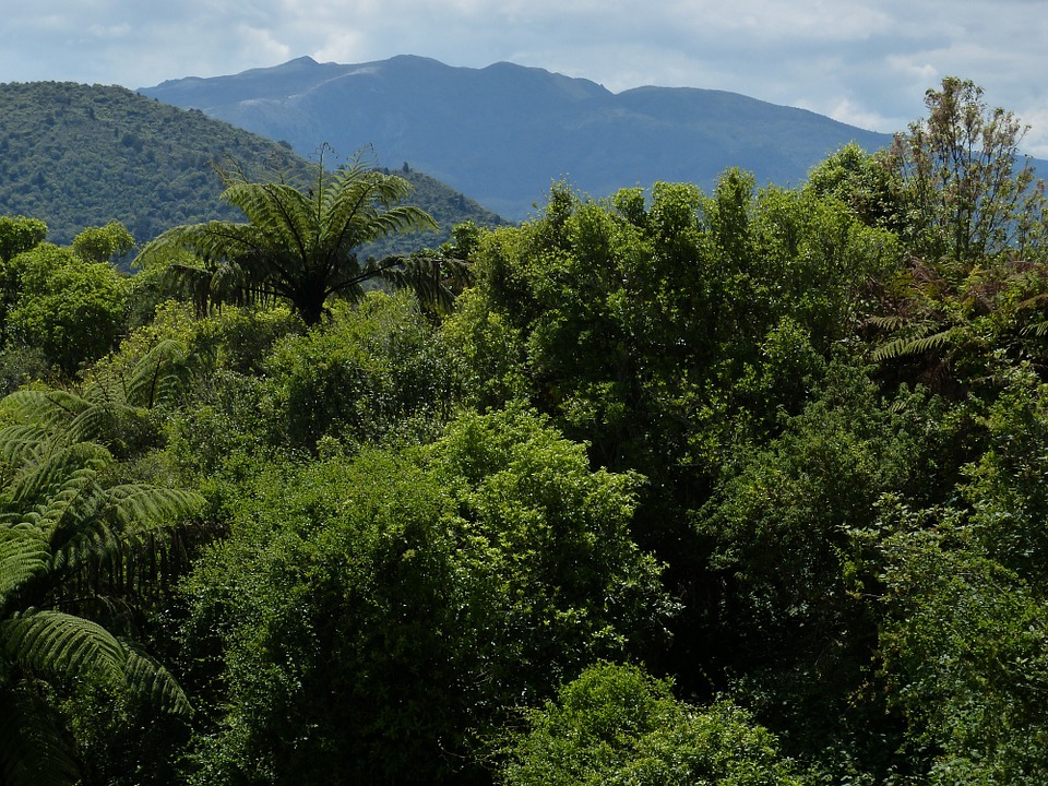
Speeding down the rural road while bolting down rny morning coffee, I was surprised and pleased to discover the hidden and charming Ness Valley-It’s gently rolling pastoral hills and the regenerating forest at their edges provided the reassuring feeling I’d escaped the rat race.
But true to the rat within, and running late as usual, I sped past the car park where I was meeting others also attending Mountain Safety Council’s intermediate bush craft course.
Ness Valley, “the nicest community on the Clevedon coast”, is about 35 minutes south of Auckland and separates the Hunua Ranges from Mataitai Forest.
While the I4,000ha Hunua Ranges are managed by Auck-land Regional Council, the 364ha Mataitai Forest is managed by DOC with volunteer assistance from members of the Manukau Tramping Club which has a working there every November.
The only public entrance point to Mataitai Forest is on Ness Valley Rd, about 4.5km from its start. The track begins by crossing 100m of farmland and then a swingbridge before entering the forest.
The Ness Valley community has installed security cameras along the road so cars are generally safe in DOC’s car park.
The six tracks in the forest are marked and signposted at intersections.
Despite the relative safety of being so close to civilisation, the Manukau Tramping Club and DOC warn the tracks are for experienced trampers only and to be conscious of which track you’re on.
Manukau Tramping Club member Peter Wooderson says the tracks can be confusing and it’s possible to get lost.
“Right, where are we?” asked Alan Stone suddenly, after an hour of silent plodding through the tanekaha, puriri, manuka and kanuka forest.
Lost in my own footsteps and feelings of wellbeing from being in the hills, I had no idea.
After getting out the map and struggling to use my compass for something other than a necklace I eventually discerned we were located about halfway between Puriri Track and MTC (Manukau Tramping Club) Loop Track.
Mataitai Forest’s track system provides a series of loop trips along the main ridge and depending on time, you can do a half day, a full day or stay at the campground on the northern side to make it an overnighter.
Being bush craft students, we were camping under flys.
A short time after getting our bearings we came to Kauri Track where there Ye views of Kawakawa Bay and further beyond to Pakihi Island.
Kauri Track runs along a ridge that is interspersed with views north and at one point we spy various signs of previous human habitation such as pits in the ground, perhaps once used by Maori or possibly loggers.
According to the Manukau Tramping Club, the history of the forest “is a bit murky”, but in 1959 a man called Charles Straka was logging it during the summer months.
Fortunately, there are now many kauri groves through the forest, the occasional mature one, the odd rimu and, like most parts of the Hunuas, very little bird song.
After stopping and starting for quick navigation tests we eventually came upon the campsite on the northern side, located on the map where Kauri Track crosses Pukurau Stream.
The stream is safe enough to source water from if filtration is used. The campsite also has a circle of stones for lighting fires and had been used recently.
We collected wood and tinder and got a blazing fire going which I fed steadily for a couple of hours while we all talked about must-have tramping gear, personal survival kits and horror hiking stories.
The feature I like about Mataitai Forest is that for its relatively small size, compared with the Hunuas or the Waitakeres, it offers a variety of trip options you can adapt as you go depending on weather and fatigue.
More importantly, our trip passed through a succession of different, but lovely sections of bush that seemed to change abruptly at some points and at others quite gradually, from one community of flora with its own set of colours into another.


